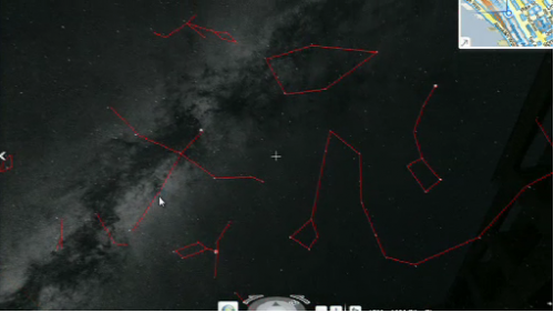
Now View The Night Sky In Bing Maps
Roughly two years ago Microsoft introduced “WorldWide Telescope.” At first it required a software download. It then was made available as a Silverlight web app. Today it’s being integrated into the new Silverlight version Bing Maps. In other words, you can now “look up at the sky” and see how space looks over that geographic […]
The Bing Maps integration of WW Telescope was demonstrated a few weeks ago by Microsoft maps architect Blaise Arcas y Aguera at the TED conference. (The WW Telescope demonstration is near the end of the video at about 7:04.) It wasn’t live for me as of the time of this writing (the images below are from the video).
Later today anyone using the Silverlight version of Bing Maps should be able to navigate to the Streetside view in Bing Maps, move the cursor to the sky and be able to see “real time information about how the space is moving over the Earth.”


According to Microsoft WW Telescope “is pulling tons of collections from the Worldwide Telescope Community including Constellations, Solar System, All-Sky Surveys, Spitzer Studies, Chandra Studies, Hubble Studies, Astrophotography, Radio Studies, NOAO Studies, Gemini Studies, Messier Catalog, Planets/Moons, Earth (Bing!), Panoramas, and Tours.”
Google offers its own images of space and constellations, Google Sky. However it’s not integrated into Google maps.
This is just the latest “cool feature” to find its way into Bing Maps. We discussed the new Silverlight version of Bing and related map apps in a previous post.


